Description
Call or E-mail or Quote
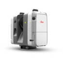
The RTC360 is the fastest laser scanner on the market with the ability to complete a scan in as little as 26 seconds. In January 2019 Latent Forensic Services and Leica Canada tested this scanner over a two day period in Whitehourse, Yukon. 9 scans were completed in 26 minutes (including scan and set-up time with a resolution of 6mm at 10 m). The scans completed on the first day were conducted at -26 degrees C and on the second day the scans were completed at -36 degrees C with a -41 windchill factor.
Leica RTC360 Product Specifications:
GENERAL
- High-speed 3D laser scanner with integrated HDR spherical imaging system and Visual Inertial System (VIS) for real time registration;
PERFORMANCE
- Data acquisition < 2 min for complete full dome scan and spherical HDR image at 6mm @ 10m resolution
- Real time registration Automatic point cloud alignment based on real time tracking of scanner movement between setups based on Visual Inertial System (VIS) by video enhanced inertial measurement unit;
- Double scan Automatic removal of moving object;
SCANNING
- Distance measurement High-speed, high dynamic time of flight enhanced by Waveform Digitizing (WFD) technology
- Laser Class 1- (in accordance with IEC 60825-1:2014), 1550nm (invisible)
- Field-of view -360° (horizontal) / 300° (vertical)
- Range- Min. 0.5 -up to 130 m
- Speed- Up to 2‘000‘000 pts / sec
- Resolution-3 user selectable settings (3/6/12m @ 10m)
- Accuracy*- Angular accuracy 18 Range accuracy 1.0 mm + 10 ppm 3D point accuracy
1.9 mm @ 10 m
2.9 mm @ 20 m
5.3 mm @ 40 m
- Range noise- 0.4 mm @ 10 m, 0.5 mm @ 20 m
IMAGING
- Camera 36 MP 3-camera system captures 432 MPx raw data for calibrated 360° x 300° spherical image
- Speed 1 minute for full spherical HDR image at any light condition
- HDR Automatic, 5 brackets
NAVIGATION SENSORS
- Visual Inertial System Video enhanced inertial measuring system to track movement of the scanner position relative to the previous setup in real time
- Tilt IMU based, Accuracy: 3‘ for any tilt
- Additional sensors Altimeter, Compass, GNSS
OPERATION
- On scanner Touch-screen control with finger touch, full colour WVGA graphic display 480 x 800 pixels
- Mobile devices Leica Cyclone FIELD 360 app for iPad or Android tablets including:
– Remote control of scan functions
– 2D & 3D data viewing
– Tagging
– Automatic alignment of scans
- Wireless Integrated wireless LAN (802.11 b/g/n)
- Data storage Leica MS256, 256GB exchangeable USB 3.0 flash drive
DESIGN & PHYSICAL
- Housing Aluminium frame and sidecovers
- Dimensions: 120mm x 240mm x 230mm / 4.7″ x 9.4″x 9.1″
- Weight 5.35kg / 11.7 lbs, nominal (w/obatteries)
- Mounting mechanism Quick mounting on 5/8“ stub on lightweight tripod / optional tribrach adapter / survey tribrach adapter available
POWER
- Internal battery 2 x Leica GEB361 internal, rechargeable Li-Ion batteries.
Duration: Typically up to 4 hours Weight: 340 g per battery - External Leica GEV282 AC adapter
ENVIRONMENTAL
- Operating temperature -5° to +40° C (Tested by Latent Forensics in Whitehorse, YT in 2019 at -36 degrees C and confirmed device was fully functional during the 26 min test with 9 scan positions).
- Storage temperature -40° to +70° C
- Dust/Humidity*** Solid particle/liquid ingress protection IP54 (IEC 60529)


